

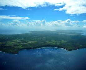
Location: Mariana Islands
How will the Mariana Islands plan for future vegetation changes?
This project develops first-ever detailed maps of ecosystem types (“landcover”) for the Mariana Islands. Native and alien plant communities are classified and delineated using high-resolution satellite imagery, data from ground surveys, and new surveys, where needed in order to ground-truth the classification. This effort informs prioritization of conservation actions and will allow projection of future vegetation changes with climate change.
Project partners:
U.S. Fish & Wildlife Service, Pacific Islands Office
Northern Mariana Commonwealth Department of Lands and Natural Resources